

May 26, 2026, 11:39 a.m. ET | ⏱️11–13 minutes
By Daniel Brooks
Over the past few years, aviation strategies in major economies around the world have turned increasing attention to low-altitude airspace. A shared vision is taking shape: quieter, more efficient, and more automated short-haul transport and aerial work.
At the heart of this shift is the move from human-centered piloting to highly autonomous—and eventually fully unmanned—low-altitude aircraft. Two technologies are driving this change: artificial intelligence (AI) and 5G-Advanced (5G-A). Neither is new, but together they are generating real momentum.
This article draws on published research, industry reports, and recent field data to unpack the logic behind the transition. It explores which changes are natural extensions of technological progress, which depend on a region’s industrial starting point, and what roles AI and next-generation networks are actually playing.
The essence of going unmanned: rebuilding flight capability, not just removing a person
It’s common to describe unmanned flight as “getting rid of the pilot.” That’s not entirely wrong, but it obscures a deeper reality. An unmanned aircraft doesn’t simply delete the human. It takes the perception, decision-making, and control skills of a capable pilot, breaks them down into digital functions, and re-implements them with technology—often exceeding human physical limits.
A useful way to think about this is to divide a pilot’s capabilities into three layers.
Perception. Humans rely on sight and hearing, which have natural limits in range, spectrum, and sustained attention. Technology aims to expand perception beyond the visible spectrum and reduce blind spots using multi-modal sensors and AI algorithms.
The StarMap Cloud Open Platform, for example, describes integrating visible-light and infrared 2D/3D perception algorithms so that drones can identify targets reliably at night or in poor visibility—something that’s hard to do with the naked eye.
In a tea plantation in Beichuan County, Sichuan, multispectral drones were deployed for regular patrols. AI analysis helps spot pest and disease risks early. According to data shared by the project operator in November 2025, the system boosted tea yields by about 7%, cut labor costs by over 25%, and increased the share of high-quality tea by 15%.
In both cases, digital perception doesn’t just replace human eyes—it creates an information-gathering capability that humans can’t match.
Decision-making. Human pilots draw on personal experience, memorized rules, and instinct. Unmanned systems shift some or all decision-making to the cloud and on-board AI.
A 2025 white paper by the Chinese Society of Aeronautics and Astronautics (Low-Altitude Economy Scenarios White Paper 2.0) notes that AI is moving aerial work from “data collection” to “intelligent diagnostics.” In city management, large volumes of drone imagery can be automatically processed by AI to spot illegal structures, road damage, waste buildup, and other issues and generate alerts—moving some judgments previously made by trained analysts earlier in the workflow.
In delivery networks, route planning and fleet scheduling algorithms adjust flight paths across an entire network based on real-time airspace conditions, weather, and orders. The overall coordination required already exceeds what a single human dispatcher can manage effectively.
That said, the reliability of such systems during rare, unexpected events remains an active area of research.
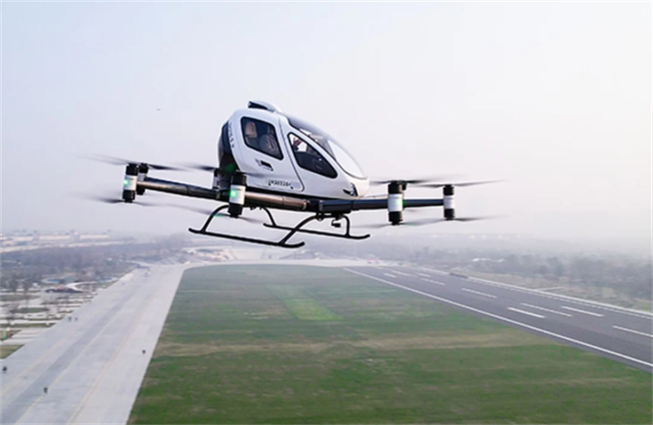
Control. Electric propulsion systems respond in milliseconds, allowing flight control software to make frequent micro-adjustments in gusty winds. 5G networks provide the low-latency link needed for beyond-visual-line-of-sight operation.
One publicly reported example comes from Deyang People’s Hospital in China. Between two of its campuses, a drone carrying close to 4 kilograms—roughly 200 vacuum blood collection tubes—makes five sample transport runs per day. It connects via 5G to a medical logistics management platform.
Project data shared by China Mobile Sichuan in November 2025 shows that sample turnaround time dropped from 15 minutes to 8 minutes, an average reduction of about 46.67%. Total flight distance accumulated had reached 20,000 kilometers.
This kind of stability comes from the machine constantly fine-tuning its attitude, not from an operator’s hand on a remote control.
Diverging paths: different starting points, different choices
Even as the world moves toward more autonomous low-altitude aircraft, clear regional differences are emerging. These are not random. They’re rooted in different aviation traditions, regulatory philosophies, and market structures.
In North America and parts of Europe, general aviation culture runs deep. There is a large pool of licensed pilots and a mature private flying market. Against this backdrop, industrial upgrading tends to focus on “empowering the existing ecosystem.” New electric vertical takeoff and landing (eVTOL) aircraft are often positioned as quieter, easier-to-fly private vehicles or short-haul charter tools.
On the regulatory side, the certification systems of the FAA and EASA are built around the pilot as the ultimate safety accountable entity. When AI starts taking on safety-critical decisions, regulators face complex questions about algorithmic transparency and human-machine responsibility. As a result, fully unmanned commercial passenger aircraft are moving toward the market at a measured pace in these regions, with a gradual increase in automation assistance being the mainstream approach.
In regions with smaller legacy general aviation fleets—particularly in some Asian countries—low-altitude activity has been envisioned from the start more as a new form of public infrastructure. With no large existing fleet and pilot community to accommodate, planners can design for large-scale, high-density unmanned operations from the ground up.
In this model, the aircraft is just a node. The real core is an “intelligent aerial road network” made up of highly reliable communication links, high-precision digital maps, and cloud-based scheduling. Some cities are experimenting with “one network, unified flights”—dispatching multiple drones carrying different payloads from a single platform to conduct inspections, with AI automatically identifying a variety of anomalies. This is the systemic approach in action. Its effectiveness, however, depends heavily on the density and reliability of communication and sensing infrastructure, and its applicability to different regions remains to be tested.
The divergence between these two paths shouldn’t be read as one being better than the other. It’s more accurate to see them as different socio-technical systems making rational choices based on their own cost, risk, and benefit calculations. A future in which multiple models coexist for a long time is entirely plausible.
AI and 5G-A: from supporting tools to foundational enablers
In this evolution, AI and 5G-A are shifting from auxiliary technologies to fundamental building blocks. AI takes on more decision-making and analytical work. 5G-A attempts to create an integrated sensing and communication digital foundation.
What makes 5G-A noteworthy is its potential for “integrated sensing and communication” (ISAC). Traditionally, communication and radar detection have been separate functions. A suitably configured 5G-A base station can send communication signals and analyze echoes at the same time, thereby detecting low-altitude objects.
Some recent field deployments offer early observations. According to a technical description provided by China Mobile Zitong Branch in November 2025, 5G-A base stations were used for low-altitude monitoring in the ancient cypress forest area of Qiqu Mountain. Conventional low-altitude radar typically has a blind zone starting about 50 meters above the ground. The wide-angle beam technology of 5G-A extended the minimum detection altitude down to about 10 meters.
The base stations can also fuse electro-optical and spectrum detection to distinguish birds from unregulated drones, reducing false alarms and focusing attention on genuine potential threats. This approach offers an alternative to traditional radar for low-altitude security management, potentially lowering the cost of fine-grained airspace surveillance. Still, its performance consistency in dense urban environments and compatibility with existing aviation safety networks need more empirical validation.
AI’s contribution is visible across a wide range of operations. The StarMap Cloud Open Platform has publicly stated that it integrates 55 categories of airborne core algorithms covering tasks like power line hazard detection, road crack identification, and low-light target detection, with an overall recognition accuracy approaching 90%. Standardized algorithm packages like this can lower the barrier to entry for low-altitude intelligence, allowing users in different industries to equip drones with inspection-grade visual understanding without starting from scratch.
Meanwhile, the Low-Altitude Economy Scenarios White Paper 2.0 reports that in drone swarm light shows, advanced control algorithms and show-design software have raised system automation to 80% and tripled script production efficiency—a small but concrete sign of AI’s progress in swarm coordination.
Programmable airspace and unsolved problems
When a critical mass of unmanned aircraft is connected to a smart scheduling network and AI-driven sensing and decision-making become common, low-altitude airspace begins to take on a new character. It stops being just physical space that aircraft fly through and starts to resemble a pool of computing resources that can be orchestrated in real time.
The white paper’s vision of “digital twin navigation,” “a territory-wide low-altitude digital foundation,” and safety systems evolving toward “proactive warning, autonomous decision-making, and automatic handling” all point in this direction. Small-scale experiments are already visible. In Xianhai, Sichuan, a November 2025 report described tourists using a smartphone mini-program to remotely dispatch a drone from a smart docking station. The drone flies a preset route and returns aerial video, making the airspace feel like a service that can be called up on demand.
But this programmability comes with governance challenges. First, the cost of building and maintaining digital low-altitude networks is not trivial. This could widen an “aerial connectivity gap” between different regions.
Second, when dense aerial traffic algorithms start deciding right-of-way and route allocation, there is as yet no mature institutional framework for defining individual route rights, privacy boundaries, and the use of public space. The white paper itself stressed the urgency of establishing unified industry standards and promoting interoperability between different systems—an implicit acknowledgment that the current low-altitude ecosystem remains quite fragmented.
Third, as systems become highly autonomous, the human role in the loop shifts from direct operator to supervisor. The skills, cognitive load, and accident liability implications of this shift have yet to be systematically addressed.
Conclusion
Taken together, the evolution from manned to unmanned low-altitude aircraft can be understood as a process of extracting aviation capability from the physiological limits of human pilots and rebuilding it as digital, networked services.
Recent publicly available project data and industry reports indicate that AI is giving unmanned systems multimodal perception and intelligent decision-making, while 5G-A is starting to demonstrate its integrated sensing and communication value in specific settings.
At the same time, different regions—shaped by their own aviation cultures, economic drivers, and regulatory histories—are taking distinctly different approaches to adopting these technologies. Which model prevails, and how fast unmanned flight penetrates different corners of daily life, will depend not just on continued technical progress but also on public trust, institutional adaptation, and the alignment of standards.
One thing is already clear: this transition is less about new generations of aircraft and more about a story in which the physical world is being reorganized by digital technology.
References
[1] Chinese Society of Aeronautics and Astronautics. (2025). Low-Altitude Economy Scenarios White Paper (2.0).
[2] StarMap Cloud Open Platform. (2025). Low-Altitude Application Algorithm Set: Technical Overview. Retrieved from platform documentation.
[3] China Mobile Sichuan Company & Partners. (2025, November). Field project data and technical descriptions shared during media site visits to Deyang, Qiqu Mountain, and Beichuan.
[4] European Union Aviation Safety Agency (EASA). (2023). EASA Artificial Intelligence Roadmap 2.0: A human-centric approach to AI in aviation.
About the Author
Daniel Brooks covers the intersection of technology, business, and industrial transformation. His reporting focuses on robotics, advanced manufacturing, cloud computing, and emerging technology markets. He aims to provide clear, evidence-based analysis of how technological innovation is reshaping industries worldwide.
Editor’s note
This article draws on a mix of industry white papers, technology platform documentation, and field data made publicly available in late 2025, primarily through reports by operators and local partners. While many of the examples come from China—where large-scale, infrastructure-led low-altitude experiments are moving quickly—the underlying questions about how AI and advanced networks reshape aviation capability are global. We’ve tried to present the evidence as it is, distinguishing clearly between documented outcomes, technology potential, and open challenges. As always, the long-term picture will be shaped by regulation, public acceptance, and real-world safety data that are still accumulating.
Recommend:
Why Aren't 3D-Printed Homes Everywhere, Despite Lower Costs Than Brick-and-Mortar?

The "Second Battlefield" of AI Chips: Why Edge Computing Has Become a Must-Win for Tech Giants

Space Manufacturing and On-Orbit Servicing: The Next Strategic High Ground of the Space Economy

From Pattern Recognition to World Simulation: How the SIMI System Builds “Physical Common Sense” for AI
